Continue to Site

Welcome to our site!

Electro Tech is an online community (with over 170,000 members) who enjoy talking about and building electronic circuits, projects and gadgets. To participate you need to register. Registration is free. Click here to register now.

  • Welcome to our site! Electro Tech is an online community (with over 170,000 members) who enjoy talking about and building electronic circuits, projects and gadgets. To participate you need to register. Registration is free. Click here to register now.

Electro-tech map!!

Status
Not open for further replies.
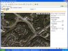
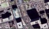
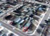
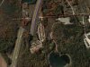
:shock: Wow :shock: I was able to zoom right into my farm. So I placed a new marker showing exactually where I am and I must say all my neighbours will be impressed when I can show them their place on the screen. Thanks heaps Jeff for providing this service Well Done Mate.

Cheers Bryan :D
 
Hi ElectroMaster,
Aw, You don't live in the mountains. I was hoping that the satellite would take a pic of you skiing!
When Google finds time to take higher resolution pics of New Zealand then we will be able to see your house.

My son spotted a jet airplane in the satellite pic near our house. It is about 20km from the airport, probably ready to turn 180 degrees for its final approach. It is cool that the jet plane has a duplicated image.

The resolution is pretty good here in Canada. You can see cars on the roads and swimming pools in backyards. I can see my house and identified it by the big trees in our front yard. :lol:

We have a hydrofoil high-speed ferry-boat that crosses a big lake here. I looked all over the lake but didn't see it. :(
 

Attachments

  • satellite_pic.jpg
    satellite_pic.jpg
    176.9 KB · Views: 338
Microslop used to have satellite images up at terraserver.microsoft.com but it apears to be down ATM, or possibly for good.
 
Wow, ElectroMaster posting something other than administrative stuff, for a change! Good to see :wink:
 
Statistics

Ok so this map currently shows only Four people in the southern hemisphere (including Santa) and about 35 in the northern hemisphere

As a quick straw-poll is this significant ? could it actually be that only 10% of the Electro-Tech-Online community live in the southern half of the world ?
 
It doesn't truly show anything.
People post a part of the world that they like, not where they live. :(
 
Speaking about the world, I've just downloaded the very detailed world satellite program from https://earth.google.com .
It is beta so it is free but it works well on my fast PC. I can spin the world, zoom in anywhere, rotate areas and even tilt them. Select where the restaurants, hospitals, gas stations etc are and all kind of cool things!
It is much clearer than the world we are using.
 

Attachments

  • earth-google1.jpg
    earth-google1.jpg
    64.9 KB · Views: 376
I downloaded it and it looks great!

But they dont have an detailed picture of where i live. :cry:
 
Maybe the satellite taking the pics travels only in the direction of our spinning earth, missing the detail near the poles. New Zealand and Alaska might be difficult.
Maybe it was cloudy the day the satellite was directly above you and it uses an older pic for your area.
Maybe you live in a cave. :lol: :lol:
 
I don't believe it.
Google earth's satellite snapped a pic of my new car in the driveway of my daughter's house. I got the car only a few weeks ago. The pic isn't very clear because the satellite is so far away. My daughter doesn't know anyone else with a red car like mine. :lol:
 

Attachments

  • sonia_s_house.jpg
    sonia_s_house.jpg
    46.3 KB · Views: 347
i like the driving directions by flying... there are some little glitches in the software (rounding errors?) like the sudden drop on HWY 401 just west of Mississauga (simulated drive to Los Angeles).
 

Attachments

  • 401_drop_top_view.jpg
    401_drop_top_view.jpg
    119.2 KB · Views: 339
  • 401_drop.jpg
    401_drop.jpg
    175.6 KB · Views: 337
It isn't an error.
It is the Niagra Escarpment. You know, that's about the height that Niagra Falls, falls and falls.
Scarborough Bluffs maybe?
It is a bit exaggerated, isn't it? :lol: :lol:
 
Nice Map

That's really something! But i didn't get it, how does it really work, the map? In the satellite mode?
Is it just a database?
 
Status
Not open for further replies.

Latest threads

Back
Top